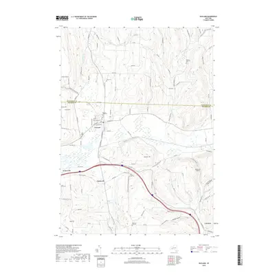
2019 Map of Wayland
USGS Topo · Published 2019About this map
Wayland serves as the primary hub of this 2019 survey, situated where the Cohocton River begins its southeastern descent through the Finger Lakes region. The landscape is defined by its transition from the steep rises of Clover Hill and Hemmer Hill to the fertile valley floors that support the settlements of Perkinsville and Patchinville. The intricate road network, featuring colorfully named routes like Pokey-Moonshine Rd and Devils Slide Rd, follows the natural contours of the land, connecting scattered homesteads and family burial grounds.
Find a feature on this map
105 named features on this map. Tap any name to fly to it.
Don’t see what you’re looking for? This feature index may not catch every label — zoom into the map to look around manually.
Map Details
Editions of this 2019 Wayland Map
This is the sole edition of this map. No revisions or reprints were ever made.
Other maps of this area

1900 · Naples
USGS Topo · 1:62,500

1902 · Wayland
USGS Topo · 1:62,500

1903 · Naples
USGS Topo · 1:62,500

1904 · Wayland
USGS Topo · 1:62,500

1910 · Bath
USGS Topo · 1:62,500

1913 · Naples
USGS Topo · 1:62,500

1915 · Hornell
USGS Topo · 1:62,500

1918 · Hornell
USGS Topo · 1:62,500

1942 · Springwater
USGS Topo · 1:31,680

1942 · Wayland
USGS Topo · 1:31,680