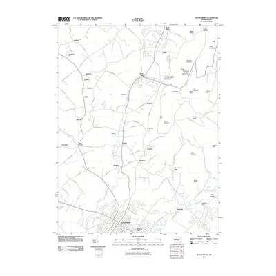
2010 Map of Waynesboro
USGS Topo · Published 2010About this map
Waynesboro serves as the primary urban center in this southern Franklin County landscape, where the dense grid of the town gives way to the agricultural and wooded slopes of the South Mountain region. The West Branch Antietam Creek and its tributaries, such as Red Run and Biesecker Run, define the drainage patterns between the various peaks and gaps. The map captures the significant presence of the Pennsylvania State University - Mount Alto Campus at Mont Alto, established on the site of a historic iron furnace operation. Numerous smaller settlements and rural crossroads like Quincy, Tomstown, and Five Forks are scattered across the valley, while the higher elevations are marked by distinctive landmarks such as The Narrows, Eagle Rock, and the Meeting of the Pines Natural Area. This 2010 survey reflects a mix of established residential areas and the enduring natural preserves of the Pennsylvania highlands.
Find a feature on this map
109 named features on this map. Tap any name to fly to it.
Don’t see what you’re looking for? This feature index may not catch every label — zoom into the map to look around manually.
Map Details
Editions of this 2010 Waynesboro Map
This is the sole edition of this map. No revisions or reprints were ever made.
Other maps of this area

1902 · Chambersburg
USGS Topo · 1:62,500

1909 · Fairfield
USGS Topo · 1:62,500

1909 · Hagerstown
USGS Topo · 1:48,000

1911 · Emmitsburg
USGS Topo · 1:62,500

1912 · Hagerstown
USGS Topo · 1:62,500

1942 · Hagerstown
USGS Topo · 1:125,000

1942 · Gettysburg
USGS Topo · 1:125,000

1943 · Emmitsburg
USGS Topo · 1:62,500

1943 · Hagerstown
USGS Topo · 1:125,000

1943 · Chambersburg
USGS Topo · 1:62,500