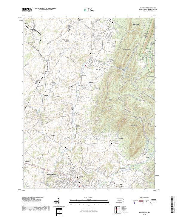
2023 Map of Waynesboro
USGS Topo · Published 2023About this map
The borough of Waynesboro serves as the focal point of this South Mountain landscape, where the valley floor transitions into the high ridges of the Appalachian National Scenic Trail. The map documents a dense network of small historic settlements like Altenwald, Quinsonia, and Tomstown, many of which developed around the West Branch Antietam Creek. Educational and spiritual life is deeply rooted here, anchored by the Pennsylvania State University-Penn State Mont Alto campus and a significant collection of family-named burial sites.
Find a feature on this map
202 named features on this map. Tap any name to fly to it.
Don’t see what you’re looking for? This feature index may not catch every label — zoom into the map to look around manually.
Map Details
Editions of this 2023 Waynesboro Map
This is the sole edition of this map. No revisions or reprints were ever made.
Other maps of this area

1902 · Chambersburg
USGS Topo · 1:62,500

1909 · Fairfield
USGS Topo · 1:62,500

1909 · Hagerstown
USGS Topo · 1:48,000

1911 · Emmitsburg
USGS Topo · 1:62,500

1912 · Hagerstown
USGS Topo · 1:62,500

1942 · Hagerstown
USGS Topo · 1:125,000

1942 · Gettysburg
USGS Topo · 1:125,000

1943 · Emmitsburg
USGS Topo · 1:62,500

1943 · Hagerstown
USGS Topo · 1:125,000

1943 · Chambersburg
USGS Topo · 1:62,500