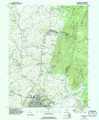
1990 Map of Waynesboro
USGS Topo · Published 1995About this map
Waynesboro serves as the focal point of this survey, where the street grid is marked by civil landmarks such as the Armory, Jr High Sch, and the 713 Library. To the north, the Penn State University (Mont Alto Campus) sits at the base of the heavily forested slopes of Michaux State Forest. The map documents a transition from the agricultural valley floor, dotted with small hamlets like Quinsonia, Altenwald, and Zullinger, to the significant elevation of Montalto Mountain and Rocky Mountain.
Find a feature on this map
78 named features on this map. Tap any name to fly to it.
Don’t see what you’re looking for? This feature index may not catch every label — zoom into the map to look around manually.
Map Details
Editions of this 1990 Waynesboro Map
This is the sole edition of this map. No revisions or reprints were ever made.
Other maps of this area

1902 · Chambersburg
USGS Topo · 1:62,500

1909 · Fairfield
USGS Topo · 1:62,500

1909 · Hagerstown
USGS Topo · 1:48,000

1911 · Emmitsburg
USGS Topo · 1:62,500

1912 · Hagerstown
USGS Topo · 1:62,500

1942 · Hagerstown
USGS Topo · 1:125,000

1942 · Gettysburg
USGS Topo · 1:125,000

1943 · Emmitsburg
USGS Topo · 1:62,500

1943 · Hagerstown
USGS Topo · 1:125,000

1943 · Chambersburg
USGS Topo · 1:62,500