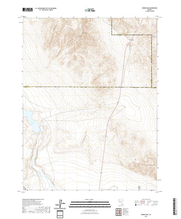
2021 Map of Weber Dam
USGS Topo · Published 2021About this map
Weber Reservoir dominates the heart of this Nevada landscape, where the Walker River flows through a terrain of stark geological contrasts. Situated near the borders of Mineral, Lyon, and Churchill counties, the area is defined by the prominent elevations of Painted Mesa and the Terrill Mountains. The hydrology of the Walker River Valley is clearly delineated, showing the infrastructure of Canal Number One and Canal Number Two as they branch away from the main river course.
Find a feature on this map
20 named features on this map. Tap any name to fly to it.
Don’t see what you’re looking for? This feature index may not catch every label — zoom into the map to look around manually.
Map Details
Editions of this 2021 Weber Dam Map
This is the sole edition of this map. No revisions or reprints were ever made.
Other maps of this area

1908 · Carson Sink
USGS Topo · 1:250,000

1909 · Hawthorne
USGS Topo · 1:250,000

1910 · Carson Sink
USGS Topo · 1:250,000

1911 · Hawthorne
USGS Topo · 1:250,000

1915 · Hawthorne
USGS Topo · 1:250,000

1948 · Walker Lake
USGS Topo · 1:250,000

1951 · Allen Springs
USGS Topo · 1:62,500

1951 · Weber Reservoir
USGS Topo · 1:62,500

1957 · Walker Lake
USGS Topo · 1:250,000

1957 · Reno
USGS Topo · 1:250,000