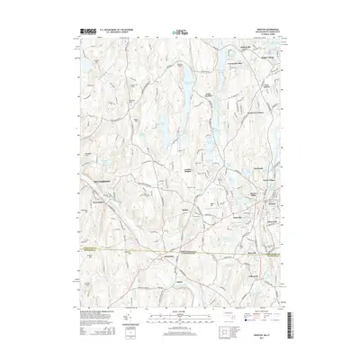
2015 Map of Webster
USGS Topo · Published 2015About this map
The French River and Quinebaug River corridors anchor this industrial and academic landscape, where the border between Massachusetts and Connecticut meets at the villages of Quinebaug and Fabyan. The textile-mill heritage of the region is evident in the cluster of named villages surrounding Webster, including North Village, Merino Village, Perryville, and Fennerville. On the heights above the river valleys, Nichols College sits as a prominent institutional landmark near Dudley, while the Dresser Hill Airport and several family-named burying grounds like Dresser Cem and Corbin Cem reflect long-standing local history. The northern portion of the map is defined by significant water management features, including the S Charlton Reservoir and the Buffumville Lake flood control project, which has transformed the area around Community Park and South Charlton into a mix of recreational space and water storage.
Find a feature on this map
215 named features on this map. Tap any name to fly to it.
Don’t see what you’re looking for? This feature index may not catch every label — zoom into the map to look around manually.
Map Details
Editions of this 2015 Webster Map
This is the sole edition of this map. No revisions or reprints were ever made.
Other maps of this area

1887 · Brookfield
USGS Topo · 1:62,500

1889 · Webster
USGS Topo · 1:62,500

1889 · Putnam
USGS Topo · 1:62,500

1890 · Brookfield
USGS Topo · 1:62,500

1892 · Woodstock
USGS Topo · 1:62,500

1892 · Webster
USGS Topo · 1:62,500

1893 · Putnam
USGS Topo · 1:62,500

1893 · Brookfield
USGS Topo · 1:62,500

1908 · Quinsigamond
USGS Topo · 1:125,000

1908 · Ware
USGS Topo · 1:125,000