2024 Map of Wedron
USGS Topo · Published 2024About this map
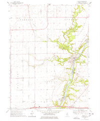
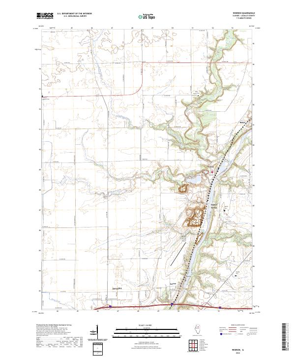
The Fox River carves a deep path through LaSalle County, serving as the central axis for a series of small riverside communities and historic burial sites. The landscape transitions from the northern edge of Ottawa through Dayton and up to the village of Wedron, where Indian Creek and Buck Creek feed into the primary waterway. This modern survey illustrates how long-established rural cemetery sites, such as Freedom Lutheran Cem, West Serena Cem, and the family-named Trumbo Cem, remain preserved amidst the surrounding agricultural grid. The presence of the Skydive Chicago Airport near the river bluffs near Sulphur Springs marks a contemporary shift in land use, while the traditional road network and namesake settlements like Blakes continue to define the area's local identity.
Find a feature on this map
65 named features on this map. Tap any name to fly to it.
Don’t see what you’re looking for? This feature index may not catch every label — zoom into the map to look around manually.
Map Details
Editions of this 2024 Wedron Map
This is the sole edition of this map. No revisions or reprints were ever made.