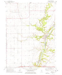
1970 Map of Wedron
USGS Topo · Published 1978About this map
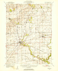
The Fox River and its confluence with Indian Creek define the geography of this area on the cusp of the 1970s. Industrial activity is evident in the clustered sandpits and gravel pits near Wedron, where the Burlington Northern railroad follows the riverbank to support local extraction. To the south, the Dayton Dam manages the river's flow near a local Gaging Sta, while the surrounding townships of Serena, Dayton, and Rutland maintain their agricultural character. Genealogical value is found in rural landmarks like Serena Cem, Debolt Cem, and Trumbo Cem, alongside local congregations at Freedom Ch and the First Nazarene Ch. The presence of Camp Tuckabatchee along the wooded bluffs of Indian Creek highlights the region's recreational use during this era.
Find a feature on this map
29 named features on this map. Tap any name to fly to it.
Don’t see what you’re looking for? This feature index may not catch every label — zoom into the map to look around manually.
Map Details
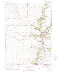
Editions of this 1970 Wedron Map
2 editions found
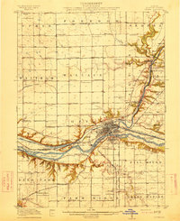
Other maps of this area

1892 · Marseilles
USGS Topo · 1:62,500

1892 · Ottawa
USGS Topo · 1:62,500
1915 · Ottawa
USGS Topo · 1:62,500

1916 · Marseilles
USGS Topo · 1:62,500
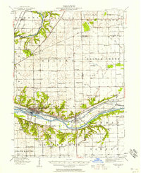
1940 · Marseilles
USGS Topo · 1:62,500

1946 · Ottawa
USGS Topo · 1:62,500

1948 · Sandwich
USGS Topo · 1:62,500

1950 · Sandwich
USGS Topo · 1:62,500
1951 · Earlville
USGS Topo · 1:62,500

1958 · Aurora
USGS Topo · 1:250,000