
1958 Map of Aurora
USGS Topo · Published 1969About this map
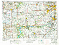
The Illinois River corridor and its industrial junctions form the backbone of this mid-century landscape, anchored by the manufacturing and transit hubs of Aurora and Joliet. The era's strategic footprint is visible at the Elwood Ordnance Plant and Kankakee Ordnance Works in the southeast, while the historic Lincoln Highway and major rail lines like the Chicago and North Western facilitate movement across the prairie. Beyond the urban centers, the map documents a robust system of recreational and conservation areas along the river bluffs, including Starved Rock State Park, Matthiessen State Park, and the Green River Wildlife Area. This document illustrates the transition from a river-and-rail economy toward the modern highway system, connecting outlying settlements like Sterling, Dixon, and Streator to the growing Chicago metropolitan fringe.
Find a feature on this map
93 named features on this map. Tap any name to fly to it.
Don’t see what you’re looking for? This feature index may not catch every label — zoom into the map to look around manually.
Map Details
Editions of this 1958 Aurora Map
3 editions found
Other maps of this area

1890 · Des Plaines
USGS Topo · 1:62,500

1891 · Riverside
USGS Topo · 1:62,500

1891 · Clinton
USGS Topo · 1:62,500

1892 · Morris
USGS Topo · 1:62,500

1892 · Marseilles
USGS Topo · 1:62,500

1892 · Joliet
USGS Topo · 1:62,500

1892 · Savanna
USGS Topo · 1:62,500

1892 · Wilmington
USGS Topo · 1:62,500

1892 · Ottawa
USGS Topo · 1:62,500

1893 · Riverside
USGS Topo · 1:62,500