Old Maps of Aurora, Illinois
Explore 61 old maps of Aurora, spanning from 1892 to today. These high-resolution historic maps reveal how streets, neighborhoods, landmarks, and natural features evolved over time — perfect for genealogy, metal detecting, research, and local history exploration.
What you can do with these maps:
- See how Aurora changed over time: Compare historical maps to modern-day views to trace roads, homesites, rail lines & more.
- View detailed metadata: Each map includes creators, publishers, year, scale, and archive source.
- Overlay maps with satellite & LiDAR: Visualize the past alongside modern tools to explore terrain & human change.
- Trusted historical sources: Maps sourced from the USGS, Library of Congress, and other archives.
- Access maps your way: View online, download high-res files, or order prints for personal or research use.
Start exploring old maps of Aurora to uncover forgotten places, hidden landmarks, and the deep history beneath your feet.
Aurora, IL maps
(61)- 1892 Map of Joliet
 1892 Joliet1892 Print · USGSWill County at the end of the nineteenth century was a bustling intersection of canal trade and heavy rail. Genealogists can trace the early streets of Joliet and Lockport or locate long-standing rural landmarks like Caton Farm and Grinton.6 unique versions available
 - 1908 Map of Wheaton
 1908 Wheaton1908 Print · USGSDuPage County was a hub of steam and electric rail travel in the years following the turn of the century. Genealogists and historians can trace the early footprints of Naperville, Downers Grove, and Wheaton, alongside notable sites like the Wheaton Driving Park.5 unique versions available
 - 1923 Map of Joliet
 1923 Joliet1923 Print · USGSJoliet and the Des Plaines River valley are shown here in the 1920s, a hub of heavy industry and vital shipping canals. Genealogists and local historians can trace family roots through numerous country schools like Spaulding School, the Du Page Church, and the expansive State Penitentiary Farm.5 unique versions available
 - 1925 Map of Yorkville
 1925 Yorkville1925 Print · USGSKendall County in the mid-twenties shows a landscape of river-valley commerce and a dense network of interurban electric rail lines. Genealogists can locate family-named schoolhouses like Tamarack School and rural hubs such as Platteville and Helmar.2 unique versions available
 - 1932 Map of Geneva
 1932 Geneva1932 Print · USGSThe Fox River valley is a hive of early twentieth-century industry and civic life. Genealogists can trace family names through rural landmarks like Johnsons Mound or the many country schools, including Red Brick Sch and Stewart Sch.3 unique versions available
 - 1948 Map of Wheaton, 1956 Print
 1948 Wheaton1956 Print · USGSDuPage County at the dawn of the post-war boom shows a landscape of growing towns connected by a dense network of steam and electric rails. Researchers can trace the early footprints of Naperville, Wheaton, and Downers Grove alongside smaller stops like Ontarioville and Eola.
 - 1948 Map of Geneva, 1964 Print
 1948 Geneva1964 Print · USGSThe Fox River valley thrives in the late 1940s, showing the industrial cores of Geneva and Batavia before the suburban boom. Trace the complex rail network through Elburn and St Charles, or locate rural landmarks like Johnsons Mound and Red Brick Sch.
 - 1950 Map of Aurora North
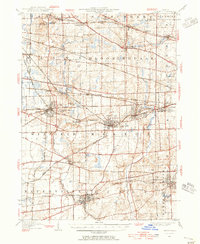
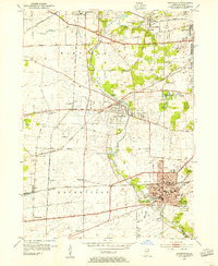
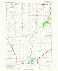
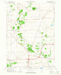
 1950 Aurora North1950 Print · USGSKane County's river-driven industrial corridor is in full mid-century expansion between Batavia and Aurora. Genealogists and researchers can trace local institutions and schools such as Mooseheart, Aurora College, and Neilson Grove Sch.
 - 1953 Map of Naperville, 1955 Print
 1953 Naperville1955 Print · USGSDuPage County was transitioning from a rural rail corridor to a suburban heartland in the early 1950s. Genealogists and historians can trace old schoolhouse sites like Round Grove Sch and landmarks including North Central College and the Winfield Sanitarium.
 - 1953 Map of Yorkville, 1955 Print
 1953 Yorkville1955 Print · USGSThe Fox River valley in the early 1950s shows the development of Kendall County just as suburban patterns began to reach the prairie. Researchers can trace historic family burial sites at Jericho Cem or locate the site of the Keck Sch (Abandoned) and Bristol (PO and Sta).3 unique versions available
 - 1953 Map of Normantown, 1955 Print
 1953 Normantown1955 Print · USGSThe rural prairies of Du Page and Will counties are shown in the early fifties as the region transitioned toward modernization. Genealogists can trace early family sites like Vermont Cem, Wheatland Sch, and the rail stop at Normantown.
 - 1954 Map of Aurora South, 1955 Print
 1954 Aurora South1955 Print · USGSThe Fox River valley and the southern reaches of Aurora are captured in the mid-fifties, showing a landscape of growing suburbs and rural prairie. Genealogists can trace family names at Mt Olivet Cem or locate the rural Oswego Prairie Ch and Scotch Sch.4 unique versions available
 - 1954 Map of Yorkville, 1959 Print
 1954 Yorkville1959 Print · USGSKendall County in the mid-1950s shows a balance between growing riverside towns and an expansive agricultural interior. Genealogists can trace family roots through rural landmarks like Naausay Ch, Jericho Cem, and the long-standing diagonal of the Old Indian Boundary.2 unique versions available
 - 1954 Map of Wheaton, 1960 Print
 1954 Wheaton1960 Print · USGSDuPage County transitions from its agricultural roots to a bustling suburban corridor during the mid-fifties. Genealogists and historians can trace institutional landmarks like the Zace Sanitarium, Old Ontarioville Cem, and Sacred Heart Academy before later development.2 unique versions available
 - 1954 Map of Joliet, 1960 Print
 1954 Joliet1960 Print · USGSMid-century Joliet and Plainfield are captured here during a period of heavy industrial and transit growth. Researchers can trace the alignment of the Lincoln Highway and find localized details like the State Prison Farm and Caton Farm.
 - 1958 Map of Aurora, 1969 Print
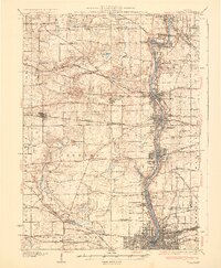
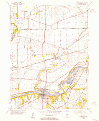
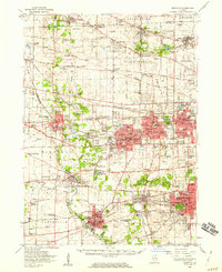
 1958 Aurora1969 Print · USGSNorthern Illinois in the late fifties shows a landscape of powerful river industry and expanding transport corridors. Genealogists and historians can trace the development of Aurora and Joliet or locate sites like the Elwood Ordnance Plant and Starved Rock.3 unique versions available
 - 1961 Map of Aurora
 1961 Aurora1961 Print · USGSNorthern Illinois at the height of the post-war era reveals a landscape of massive industrial works and thriving river towns. Genealogists and historians can trace the paths of the Lincoln Highway or locate long-standing landmarks like the Green River Ordnance Plant and Starved Rock State Park.
 - 1962 Map of Normantown, 1963 Print
 1962 Normantown1963 Print · USGSThe Illinois prairie near the Du Page and Will County line is shown here in the early sixties as it transitions from agriculture to industry. You can trace early settlement roots at Vermont Cem or locate former aviation sites like Matter Airport and Aero Airport.3 unique versions available
 - 1962 Map of Naperville, 1964 Print
 1962 Naperville1964 Print · USGSMid-century DuPage County shows a landscape transitioning from quiet river towns to bustling suburbs connected by the new East-West Tollway. Genealogists and historians can trace institutional roots at North Central College, the Winfield Sanitarium, and Naperville Cem.4 unique versions available
 - 1964 Map of Aurora North, 1965 Print
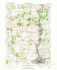
 1964 Aurora North1965 Print · USGSThe Fox River valley in the mid-sixties shows the transition from industrial river towns to expanding suburbs. Researchers can trace the development of civic life through sites like Mooseheart, the Aurora Downs track, and the historic Campana landmark.3 unique versions available
 - 1964 Map of Sugar Grove, 1965 Print
 1964 Sugar Grove1965 Print · USGSSugar Grove and its surrounding Kane County townships are shown in the mid-1960s as the area balanced its rural roots with new infrastructure. Genealogists and local historians can locate the Sugar Grove Cem, Camp Ka-De-Ka, and the early layout of the Aurora Municipal Airport.3 unique versions available
 - 1985 Map of Aurora, 1989 Print
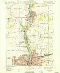
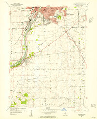
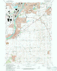
 1985 Aurora1989 Print · USGSNortheastern Illinois is captured in the mid-1980s as suburban growth began to bridge the gap between the Fox River cities and the outer prairies. Researchers can trace the development of Naperville and Aurora or locate rural landmarks like Fairview Cem and the Illinois and Michigan Canal.
 - 1993 Map of Aurora South, 1994 Print
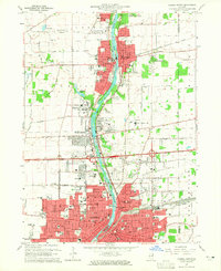
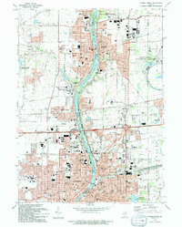
 1993 Aurora South1994 Print · USGSThe Fox River corridor shows significant suburban growth in the early nineties as residential developments expand around Oswego. Genealogists and local historians can trace family sites at Oswego Prairie Cemetery and the small settlement of Wolfs.
 - 1993 Map of Yorkville, 1994 Print
 1993 Yorkville1994 Print · USGSThe Fox River valley in the early nineties shows a landscape of river-front parks and historic transit routes. Genealogists can trace family names at St Patricks Cem and Oak Grove Cem or locate the Glen D Palmer State Game Farm.
 - 1993 Map of Aurora North, 1994 Print
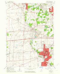
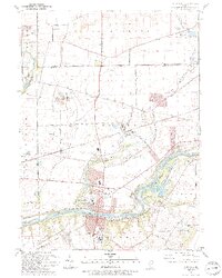
 1993 Aurora North1994 Print · USGSThe Fox River valley was thriving in the 1990s as it balanced industrial heritage with cutting-edge science and education. Genealogists and researchers can locate numerous landmarks including Mt Olivet Cem, the Marmion Military Academy, and the Fermi National Accelerater Laboratory.
Showing maps 1-25 of 61
Top cities near Aurora
- Joliet historical maps
- Naperville historical maps
- Elgin historical maps
- Bolingbrook historical maps
- Wayne historical maps
- Wheaton historical maps
See more
Frequently asked questions
- What are the different types of historical maps available for Aurora?
- What is the oldest map of Aurora?
- Where can I purchase historical maps of Aurora for my home or office?
- Where can I download high-res historical maps of Aurora?
- Are there historical topographic maps available for Aurora?
- Is there historical aerial imagery available for Aurora?
- Where are historical maps of Aurora sourced from?