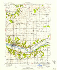
1940 Map of Marseilles
USGS Topo · Published 1958About this map
Marseilles serves as the industrial and transportation anchor for this portion of the Illinois River valley, where the historic Illinois and Michigan Canal runs parallel to the modern Chicago Rock Island and Pacific RR. The landscape reflects a dense 19th-century educational network, evidenced by numerous rural schoolhouses such as the Fox River Academy, Aronson School, and Peddicord School that served the outlying farming townships. North of the river, the Fox River meanders through Serena and past the Norwegian settlement at Norway, while the southern plains are defined by drainage runs like Armstrong Run and Hog Run. A notable transit artifact is the Chicago and Peoria Electric (Abandoned) line, which traces the northern bluffs of the valley near Crotty (Seneca PO).
Find a feature on this map
87 named features on this map. Tap any name to fly to it.
Don’t see what you’re looking for? This feature index may not catch every label — zoom into the map to look around manually.
Map Details
Editions of this 1940 Marseilles Map
This is the sole edition of this map. No revisions or reprints were ever made.
Other maps of this area

1892 · Morris
USGS Topo · 1:62,500

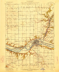
1892 · Marseilles
USGS Topo · 1:62,500

1892 · Ottawa
USGS Topo · 1:62,500
1915 · Ottawa
USGS Topo · 1:62,500

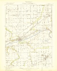
1916 · Marseilles
USGS Topo · 1:62,500
1918 · Morris
USGS Topo · 1:62,500

1925 · Yorkville
USGS Topo · 1:62,500

1925 · Streator
USGS Topo · 1:62,500
1927 · Streator
USGS Topo · 1:62,500

1946 · Ottawa
USGS Topo · 1:62,500