
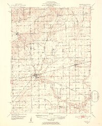
1951 Map of Earlville
USGS Topo · Published 1952About this map
Agricultural lands and intersecting rail lines define this mid-century survey of the Lee and La Salle County border. The commercial center of Earlville serves as a primary hub where the Chicago Burlington and Quincy and the Chicago and North Western railroads meet. The landscape is dotted with small-town settlements and rural infrastructure, from the village of Leland to the more isolated community at Paw Paw.
Find a feature on this map
53 named features on this map. Tap any name to fly to it.
Don’t see what you’re looking for? This feature index may not catch every label — zoom into the map to look around manually.
Map Details
Editions of this 1951 Earlville Map
2 editions found
Other maps of this area

1892 · Marseilles
USGS Topo · 1:62,500

1892 · Ottawa
USGS Topo · 1:62,500

1893 · Lasalle
USGS Topo · 1:62,500

1911 · La Salle
USGS Topo · 1:62,500

1913 · La Salle
USGS Topo · 1:62,500

1915 · Ottawa
USGS Topo · 1:62,500

1916 · Marseilles
USGS Topo · 1:62,500

1934 · De Kalb
USGS Topo · 1:62,500

1937 · De Kalb
USGS Topo · 1:62,500

1937 · Sycamore
USGS Topo · 1:62,500