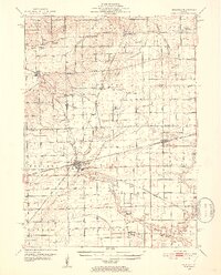
1951 Map of Earlville
USGS Topo · Published 1952About this map
The prairie landscape of north-central Illinois unfolds across this 1951 survey, capturing a region defined by its rail junctions and agricultural hamlets. The city of Earlville serves as a primary hub, situated at the intersection of the Chicago and North Western and the Chicago Burlington and Quincy railroads. This network supported numerous smaller grain-shipping points and rural stops like Leland, Paw Paw, and the small settlement at Sutphens.
Find a feature on this map
44 named features on this map. Tap any name to fly to it.
Don’t see what you’re looking for? This feature index may not catch every label — zoom into the map to look around manually.
Map Details
Editions of this 1951 Earlville Map
2 editions found

Other maps of this area

1892 · Marseilles
USGS Topo · 1:62,500

1892 · Ottawa
USGS Topo · 1:62,500

1893 · Lasalle
USGS Topo · 1:62,500

1911 · La Salle
USGS Topo · 1:62,500

1913 · La Salle
USGS Topo · 1:62,500

1915 · Ottawa
USGS Topo · 1:62,500

1916 · Marseilles
USGS Topo · 1:62,500

1934 · De Kalb
USGS Topo · 1:62,500

1937 · De Kalb
USGS Topo · 1:62,500

1937 · Sycamore
USGS Topo · 1:62,500