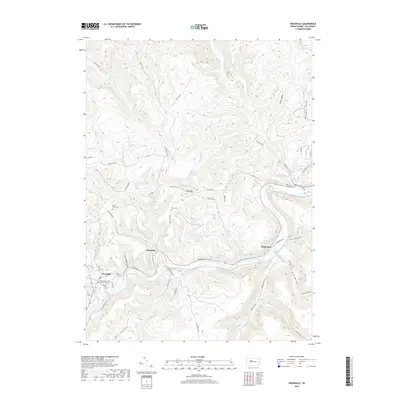
2019 Map of Weedville
USGS Topo · Published 2019About this map
Bennett Branch Sinnemahoning Creek carves a deep valley through this Elk County landscape, providing the primary corridor for the settlements of Weedville, Caledonia, and Medix Run. The 2019 survey illustrates a classic Appalachian ridge-and-hollow pattern, where dozens of named drainages like Wolf Lick Run, Trout Run, and Silvermill Hollow Run feed the central waterway. Local family names and geography are preserved in features such as Gray Hill, Barr Hollow, and Chase Hollow. Several burial grounds are documented across the terrain, including Weedville United Methodist Cem and the more isolated Mount Zion Cem. The road network, including River Rd and Winslow Hill Rd, clings to the valley floors and higher elevations, showing how contemporary infrastructure navigates the steep relief of the region.
Find a feature on this map
72 named features on this map. Tap any name to fly to it.
Don’t see what you’re looking for? This feature index may not catch every label — zoom into the map to look around manually.
Map Details
Editions of this 2019 Weedville Map
This is the sole edition of this map. No revisions or reprints were ever made.
Other maps of this area

1929 · Clearfield
USGS Topo · 1:48,000

1929 · Penfield
USGS Topo · 1:62,500

1932 · Clearfield
USGS Topo · 1:62,500

1932 · Penfield
USGS Topo · 1:62,500

1941 · Benezette
USGS Topo · 1:62,500

1941 · Ridgway
USGS Topo · 1:62,500

1943 · Benezette
USGS Topo · 1:62,500

1944 · Ridgway
USGS Topo · 1:62,500

1957 · Warren
USGS Topo · 1:250,000

1958 · Warren
USGS Topo · 1:250,000
Featured Places
- Benezette Township, PA
- Jay Township, PA
- Caledonia, Jay Township
- Weedville, Jay Township
- Medix Run, Benezette Township