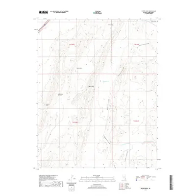
2018 Map of Weiser Ridge
USGS Topo · Published 2018About this map
Weiser Ridge and the North Muddy Mountains dominate this high-desert landscape in northeastern Clark County. This 2018 survey documents a rugged corner of the Mojave Desert where drainage patterns like Anderson Wash and Logan Wash carve through the arid terrain toward the Moapa Valley. The map highlights modern recreation through the Bikepacking: The Plateau Passage, a long-distance trail system that winds through the elevation changes of Weiser Valley and along California Ridge. Notable geographic formations such as The Bowl are clearly defined, providing a contemporary view of the region's topographical complexity and its network of seasonal washes including the Magnesite Wash and branches of the Overton Wash.
Find a feature on this map
19 named features on this map. Tap any name to fly to it.
Don’t see what you’re looking for? This feature index may not catch every label — zoom into the map to look around manually.
Map Details
Editions of this 2018 Weiser Ridge Map
This is the sole edition of this map. No revisions or reprints were ever made.
Other maps of this area

1886 · Saint Thomas
USGS Topo · 1:250,000

1893 · Saint Thomas
USGS Topo · 1:250,000

1926 · Bonelli
USGS Topo · 1:96,000

1926 · Boulder Canyon
USGS Topo · 1:96,000

1953 · Muddy Peak
USGS Topo · 1:62,500

1953 · Overton Beach
USGS Topo · 1:62,500

1954 · Las Vegas
USGS Topo · 1:250,000

1957 · Las Vegas
USGS Topo · 1:250,000

1958 · Moapa
USGS Topo · 1:62,500

1958 · Overton
USGS Topo · 1:62,500