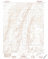
1983 Map of Weiser Ridge
USGS Topo · Published 1983About this map
Valley of Fire State Park dominates the southeastern portion of this 1983 survey, revealing a landscape defined by dramatic geological formations and arid drainage systems. The northeastern corner is anchored by the Muddy River and the Union Pacific rail corridor, reflecting a critical transportation artery through the Nevada desert. Between these points, the land is carved into distinct territories like Weiser Valley and The Bowl, framed by the formidable heights of Weiser Ridge and the Muddy Mountains.
Find a feature on this map
17 named features on this map. Tap any name to fly to it.
Don’t see what you’re looking for? This feature index may not catch every label — zoom into the map to look around manually.
Map Details
Editions of this 1983 Weiser Ridge Map
This is the sole edition of this map. No revisions or reprints were ever made.
Other maps of this area

1886 · Saint Thomas
USGS Topo · 1:250,000

1893 · Saint Thomas
USGS Topo · 1:250,000

1926 · Bonelli
USGS Topo · 1:96,000

1926 · Boulder Canyon
USGS Topo · 1:96,000

1953 · Muddy Peak
USGS Topo · 1:62,500

1953 · Overton Beach
USGS Topo · 1:62,500

1954 · Las Vegas
USGS Topo · 1:250,000

1957 · Las Vegas
USGS Topo · 1:250,000

1958 · Moapa
USGS Topo · 1:62,500

1958 · Overton
USGS Topo · 1:62,500