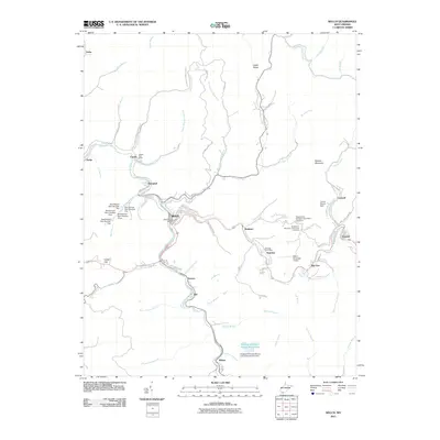
2011 Map of Welch
USGS Topo · Published 2011About this map
The Tug Fork and Elkhorn Creek define the industrial and residential corridors of McDowell County, where the city of Welch sits at their confluence. This 2011 survey illustrates a landscape deeply shaped by the coal economy, evidenced by numerous water-control and industrial structures such as Grapevine Branch Refuse and Impoundment Dam and several Mod Branch Dams. Beyond the city center, smaller settlements like Hemphill, Maitland, and Wilcoe line the narrow valley floors. Elevated above these valleys, Belcher Mountain hosts both the New Belcher Mountain Community Cemetery and the Old Belcher Mountain Community Cemetery, providing a focal point for local genealogical research. The map also traces the infrastructure of the early 21st century, from the Welch Municipal Airport to the various post offices including the Capels and Superior locations.
Find a feature on this map
70 named features on this map. Tap any name to fly to it.
Don’t see what you’re looking for? This feature index may not catch every label — zoom into the map to look around manually.
Map Details
Editions of this 2011 Welch Map
This is the sole edition of this map. No revisions or reprints were ever made.
Other maps of this area

1887 · Pocahontas
USGS Topo · 1:125,000

1891 · Tazewell
USGS Topo · 1:125,000

1891 · Pocahontas
USGS Topo · 1:125,000

1891 · Oceana
USGS Topo · 1:125,000

1891 · Raleigh
USGS Topo · 1:125,000

1893 · Oceana
USGS Topo · 1:125,000

1894 · Pocahontas
USGS Topo · 1:125,000

1895 · Tazewell
USGS Topo · 1:125,000

1895 · Pocahontas
USGS Topo · 1:125,000

1897 · Tazewell
USGS Topo · 1:125,000