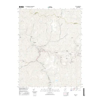
2016 Map of Welch
USGS Topo · Published 2016About this map
Welch serves as the focal point of this McDowell County landscape, where the confluence of Elkhorn Cr and Little Cub Br dictates the winding urban footprint. The town’s complex street grid, featuring Virginia Ave and Court St, follows the narrow valley floors, illustrating the traditional Appalachian development pattern where settlements are tightly squeezed between steep ridges. Along the heights of Indian Ridge and Belcher Mtn, the geography shifts toward more sparse residential clusters and infrastructure. Local heritage is preserved at sites like the Old Belcher Mountain Community Cem and the New Belcher Mountain Community Cem. Small industrial and residential hubs including Hemphill, Maitland, and Wilcoe are connected by the highway and rail corridors that track the creek beds, while the Welch Municipal Airport occupies one of the few level clearings on the plateau above Superior.
Find a feature on this map
95 named features on this map. Tap any name to fly to it.
Don’t see what you’re looking for? This feature index may not catch every label — zoom into the map to look around manually.
Map Details
Editions of this 2016 Welch Map
This is the sole edition of this map. No revisions or reprints were ever made.
Other maps of this area

1887 · Pocahontas
USGS Topo · 1:125,000

1891 · Tazewell
USGS Topo · 1:125,000

1891 · Pocahontas
USGS Topo · 1:125,000

1891 · Oceana
USGS Topo · 1:125,000

1891 · Raleigh
USGS Topo · 1:125,000

1893 · Oceana
USGS Topo · 1:125,000

1894 · Pocahontas
USGS Topo · 1:125,000

1895 · Tazewell
USGS Topo · 1:125,000

1895 · Pocahontas
USGS Topo · 1:125,000

1897 · Tazewell
USGS Topo · 1:125,000