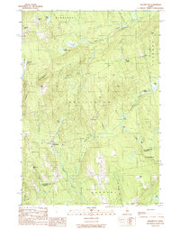
1989 Map of Wellington
USGS Topo · Published 1989About this map
Wellington serves as the primary crossroads in this rural section of Piscataquis and Somerset Counties during the late 1980s. The landscape is defined by a dense network of water bodies and wetlands, including Woodman Bog, Whitehouse Bog, and Wellington Bog, which feed into Higgins Stream and Ferguson Brook. Small settlements and family-named intersections like Burdin Corner, Hutchins Corner, and Huff Corner reflect the area's genealogical history and early land divisions. Natural elevations such as Huff Mountain and King Hill rise above the drainage basins of Meadow Brook and Buzzell Brook. Local industry is represented by Gravel Pits located near the southern boundary with Harmony, indicating the ongoing extraction of glacial deposits. This document captures the transition between organized townships and the more sparsely settled Kingsbury Plantation.
Find a feature on this map
43 named features on this map. Tap any name to fly to it.
Don’t see what you’re looking for? This feature index may not catch every label — zoom into the map to look around manually.
Map Details
Editions of this 1989 Wellington Map
This is the sole edition of this map. No revisions or reprints were ever made.
Other maps of this area

1913 · Skowhegan
USGS Topo · 1:62,500

1930 · Pittsfield
USGS Topo · 1:48,000

1932 · Pittsfield
USGS Topo · 1:62,500

1933 · Pittsfield
USGS Topo · 1:62,500

1933 · Guilford
USGS Topo · 1:62,500

1937 · Guilford
USGS Topo · 1:62,500

1948 · Bangor
USGS Topo · 1:250,000

1948 · Kingsbury
USGS Topo · 1:62,500

1950 · Kingsbury
USGS Topo · 1:62,500

1954 · Millinocket
USGS Topo · 1:250,000