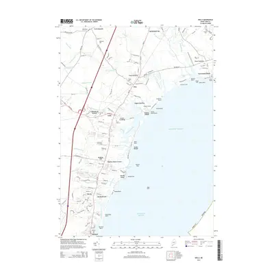
2014 Map of Wells
USGS Topo · Published 2014About this map
The coastal communities of southern Maine are documented here just after the turn of the 21st century, showing the intricate relationship between the Atlantic shoreline and the tidal river systems. The Webhannet River and Mousam River snake through salt marshes and estuary lands, defining the development patterns of Wells Beach and Kennebunk Beach. Inland, the landscape transitions to wooded hills and agricultural corridors like Wells Branch, where the Wells Branch Church Cem stands as a local landmark.
Find a feature on this map
130 named features on this map. Tap any name to fly to it.
Don’t see what you’re looking for? This feature index may not catch every label — zoom into the map to look around manually.
Map Details
Editions of this 2014 Wells Map
This is the sole edition of this map. No revisions or reprints were ever made.
Other maps of this area

1891 · Biddeford
USGS Topo · 1:62,500

1891 · Kennebunk
USGS Topo · 1:62,500

1893 · Kennebunk
USGS Topo · 1:62,500

1893 · York
USGS Topo · 1:62,500

1893 · Biddeford
USGS Topo · 1:62,500

1898 · Kennebunk
USGS Topo · 1:62,500

1920 · York
USGS Topo · 1:62,500

1941 · Biddeford
USGS Topo · 1:62,500

1941 · Kennebunk
USGS Topo · 1:62,500

1944 · Wells
USGS Topo · 1:24,000