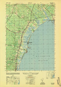
1949 Map of Wells
USGS Topo · Published 1949About this map
Wells Beach (Webhannet PO) serves as a primary coastal hub in this late 1940s landscape, where the Webhannet River flows through expansive tidal marshes behind the barrier beach. The inland economy and social structure are evidenced by institutional landmarks like the Wells Poor Farm and several local educational sites including Wells Sch No 3. The transportation network is defined by the Boston and Maine RR, which links the interior at Wells Beach Station to the developing shore. Moving north, the map reveals the transition into Kennebunk, with the Mousam River meeting the sea at Kennebunk Beach. Local crossroads such as Charles Chase Corner and Four Corners anchor the rural road system, while the Kentucky Riding Club suggests the recreational character of the era. The mapping of Moody Beach and Ogunquit Beach captures the coastal geography just as post-war development began to shape the Maine shoreline.
Find a feature on this map
43 named features on this map. Tap any name to fly to it.
Don’t see what you’re looking for? This feature index may not catch every label — zoom into the map to look around manually.
Map Details
Editions of this 1949 Wells Map
This is the sole edition of this map. No revisions or reprints were ever made.
Other maps of this area

1891 · Biddeford
USGS Topo · 1:62,500

1891 · Kennebunk
USGS Topo · 1:62,500

1893 · Kennebunk
USGS Topo · 1:62,500

1893 · York
USGS Topo · 1:62,500

1893 · Biddeford
USGS Topo · 1:62,500

1898 · Kennebunk
USGS Topo · 1:62,500

1920 · York
USGS Topo · 1:62,500

1941 · Biddeford
USGS Topo · 1:62,500

1941 · Kennebunk
USGS Topo · 1:62,500

1944 · Wells
USGS Topo · 1:24,000