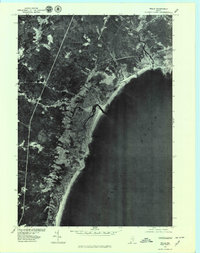
1977 Map of Wells
USGS Topo · Published 1979About this map
Wells and its adjacent coastal reaches are captured here through detailed aerial imagery from the late 1970s. This orthophotoquad provides a clear view of the development patterns along the Maine shoreline, specifically the dense clusters around Moody Point and the stretch of Wells Beach. The relationship between the tidal marshes and the sea is evident as the Webhannet River winds behind the barrier beach before meeting the Atlantic Ocean.
Find a feature on this map
9 named features on this map. Tap any name to fly to it.
Don’t see what you’re looking for? This feature index may not catch every label — zoom into the map to look around manually.
Map Details
Editions of this 1977 Wells Map
This is the sole edition of this map. No revisions or reprints were ever made.
Other maps of this area

1891 · Biddeford
USGS Topo · 1:62,500

1891 · Kennebunk
USGS Topo · 1:62,500

1893 · Kennebunk
USGS Topo · 1:62,500

1893 · York
USGS Topo · 1:62,500

1893 · Biddeford
USGS Topo · 1:62,500

1898 · Kennebunk
USGS Topo · 1:62,500

1920 · York
USGS Topo · 1:62,500

1941 · Biddeford
USGS Topo · 1:62,500

1941 · Kennebunk
USGS Topo · 1:62,500

1944 · Wells
USGS Topo · 1:24,000