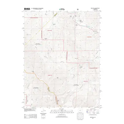
2013 Map of Wellsville
USGS Topo · Published 2013About this map
Wellsville and the surrounding high-altitude terrain of Fremont County are defined by the winding course of the Arkansas River as it carves through Box Canyon. This mountain landscape is characterized by its hydrothermal activity, noted by the presence of Wellsville Warm Spring and Swissvale Warm Springs along the river corridor. The map details a transition from the river valley to the steep elevations of the San Isabel National Forest and Rio Grande National Forest, where peaks like Simmons Peak and Hunts Peak dominate the skyline. The settlement of Calcite sits tucked away in the eastern hills, connected by a network of drainage-carved landforms such as Badger Gulch and Porter Gulch. For those navigating the backcountry, the Rainbow Trail 1336 and Hunts Lake Trail 1405 provide established routes through this complex geography of gulches and creeks.
Find a feature on this map
49 named features on this map. Tap any name to fly to it.
Don’t see what you’re looking for? This feature index may not catch every label — zoom into the map to look around manually.
Map Details
Editions of this 2013 Wellsville Map
This is the sole edition of this map. No revisions or reprints were ever made.
Other maps of this area

1954 · Pueblo
USGS Topo · 1:250,000

1956 · Cameron Mountain
USGS Topo · 1:62,500

1956 · Poncha Springs
USGS Topo · 1:62,500

1956 · Montrose
USGS Topo · 1:250,000

1957 · Pueblo
USGS Topo · 1:250,000

1958 · Pueblo
USGS Topo · 1:250,000

1959 · Montrose
USGS Topo · 1:250,000

1959 · Bonanza
USGS Topo · 1:62,500

1959 · Howard
USGS Topo · 1:62,500

1960 · Montrose
USGS Topo · 1:250,000