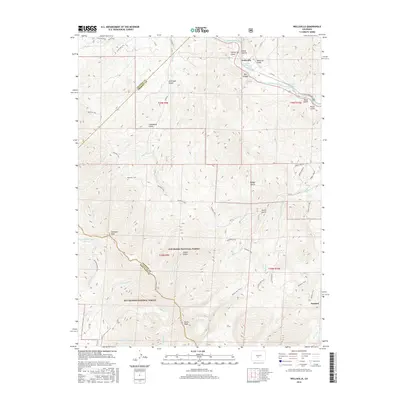
2016 Map of Wellsville
USGS Topo · Published 2016About this map
Arkansas River frontage and the thermal waters of Swissvale Warm Springs and Wellsville Warm Spring characterize this portion of Fremont County. The settlement of Wellsville sits near Box Canyon, while the community of Howard occupies the southeastern reach near Cherry Cr. This area is defined by the high-elevation divide between the San Isabel National Forest and Rio Grande National Forest, marked by prominent summits such as Simmons Peak and Hunts Peak.
Find a feature on this map
53 named features on this map. Tap any name to fly to it.
Don’t see what you’re looking for? This feature index may not catch every label — zoom into the map to look around manually.
Map Details
Editions of this 2016 Wellsville Map
This is the sole edition of this map. No revisions or reprints were ever made.
Other maps of this area

1954 · Pueblo
USGS Topo · 1:250,000

1956 · Cameron Mountain
USGS Topo · 1:62,500

1956 · Poncha Springs
USGS Topo · 1:62,500

1956 · Montrose
USGS Topo · 1:250,000

1957 · Pueblo
USGS Topo · 1:250,000

1958 · Pueblo
USGS Topo · 1:250,000

1959 · Montrose
USGS Topo · 1:250,000

1959 · Bonanza
USGS Topo · 1:62,500

1959 · Howard
USGS Topo · 1:62,500

1960 · Montrose
USGS Topo · 1:250,000