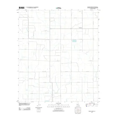
2012 Map of Welsh North
USGS Topo · Published 2012About this map
Pine Island and the surrounding agricultural landscape of Jefferson Davis Parish are defined by an intricate network of drainage and bayous. In this corner of Southwest Louisiana, water management is evident through the winding paths of Little Bayou, E Bayou Lacassine, and the aptly named Gum Gully. The local infrastructure is deeply connected to family-named routes such as Chaisson Rd and Meche Rd, while the northern edge is marked by the LaBleu Cem. Economic activity in the early 21st century is anchored by the North Welsh Gas Field, appearing alongside a grid of rural roads that serve the surrounding rice and crawfish fields. The transition between natural waterways like E Bayou Grand Marais and engineered routes such as Parish Road 619A reflects the enduring marriage of the land's hydraulic nature with the requirements of modern energy and agriculture.
Find a feature on this map
35 named features on this map. Tap any name to fly to it.
Don’t see what you’re looking for? This feature index may not catch every label — zoom into the map to look around manually.
Map Details
Editions of this 2012 Welsh North Map
This is the sole edition of this map. No revisions or reprints were ever made.
Other maps of this area

1946 · Lacassine
USGS Topo · 1:31,680

1946 · Jennings
USGS Topo · 1:31,680

1947 · Kinder
USGS Topo · 1:31,680

1947 · Fenton
USGS Topo · 1:31,680

1947 · Pine Island
USGS Topo · 1:31,680

1947 · Welsh
USGS Topo · 1:31,680

1947 · Elton
USGS Topo · 1:31,680

1947 · Edna
USGS Topo · 1:31,680

1947 · Hathaway
USGS Topo · 1:31,680

1950 · Fenton
USGS Topo · 1:31,680