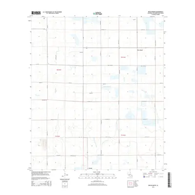
2015 Map of Welsh North
USGS Topo · Published 2015About this map
The agricultural lands of Jefferson Davis Parish north of Welsh are defined by a network of drainage bayous and geometric road grids. The landscape is characterized by the meandering courses of Little Bayou and E Bayou Lacassine, which contrast with the straight alignments of local thoroughfares like Cormier Village Rd and Pecan Orchard Rd. This 2015 survey reveals a terrain managed for rice or crawfish production, common to this part of the Louisiana prairie, where waterways like Gum Gully and E Bayou Grand Marais provide essential irrigation and drainage. Small-scale landmarks and historic markers include LaBleu Cem in the northwest and the small community of Pine Island to the northeast. The map provides a contemporary record of property divisions and rural infrastructure, from a Radio Tower Rd to the various parish roads that partition the townships.
Find a feature on this map
38 named features on this map. Tap any name to fly to it.
Don’t see what you’re looking for? This feature index may not catch every label — zoom into the map to look around manually.
Map Details
Editions of this 2015 Welsh North Map
This is the sole edition of this map. No revisions or reprints were ever made.
Other maps of this area

1946 · Lacassine
USGS Topo · 1:31,680

1946 · Jennings
USGS Topo · 1:31,680

1947 · Kinder
USGS Topo · 1:31,680

1947 · Fenton
USGS Topo · 1:31,680

1947 · Pine Island
USGS Topo · 1:31,680

1947 · Welsh
USGS Topo · 1:31,680

1947 · Elton
USGS Topo · 1:31,680

1947 · Edna
USGS Topo · 1:31,680

1947 · Hathaway
USGS Topo · 1:31,680

1950 · Fenton
USGS Topo · 1:31,680