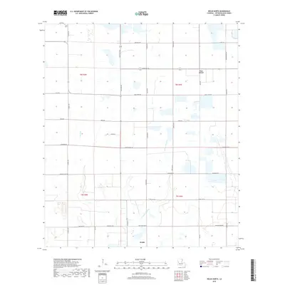
2018 Map of Welsh North
USGS Topo · Published 2018About this map
Jefferson Davis Parish rice and crawfish country is defined by a intricate network of irrigation and drainage in this 2018 survey. The northern edge of Welsh anchors the map, giving way to a landscape dominated by agricultural sections and the meandering paths of E Bayou Lacassine and E Bayou Grand Marais. Small pockets of higher ground are marked by historic labels like Pine Island, while local genealogy is rooted at LaBleu Cem in the northwest corner. A grid of named parish roads, including Cormier Village Rd and Pecan Orchard Rd, reveals the family-oriented land ownership patterns typical of the Louisiana prairie. The presence of Gum Gully and Little Bayou illustrates the hydrology of this low-lying region before it transitions toward the larger coastal marshes further south.
Find a feature on this map
36 named features on this map. Tap any name to fly to it.
Don’t see what you’re looking for? This feature index may not catch every label — zoom into the map to look around manually.
Map Details
Editions of this 2018 Welsh North Map
This is the sole edition of this map. No revisions or reprints were ever made.
Other maps of this area

1946 · Lacassine
USGS Topo · 1:31,680

1946 · Jennings
USGS Topo · 1:31,680

1947 · Kinder
USGS Topo · 1:31,680

1947 · Fenton
USGS Topo · 1:31,680

1947 · Pine Island
USGS Topo · 1:31,680

1947 · Welsh
USGS Topo · 1:31,680

1947 · Elton
USGS Topo · 1:31,680

1947 · Edna
USGS Topo · 1:31,680

1947 · Hathaway
USGS Topo · 1:31,680

1950 · Fenton
USGS Topo · 1:31,680