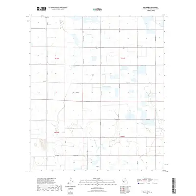
2020 Map of Welsh North
USGS Topo · Published 2020About this map
Welsh and the surrounding agricultural lands of Jefferson Davis Parish are defined by an intricate network of drainage and transport at the start of the 2020s. The landscape is characterized by its reliance on water management, featuring several significant waterways such as E Bayou Lacassine and E Bayou Grand Marais, which weave through the prairie alongside Gum Gully. These natural bayous are interspersed with a rigid grid of local roads named for prominent families and landmarks, such as Cormier Village Rd and Pecan Orchard Rd. North of the main settlement, the community of Pine Island sits along Litteral Rd. The presence of the LeBleu Cem in the northwestern corner provides a fixed point for genealogical research in this coastal prairie region, reflecting the long-standing French and Acadian heritage that shaped the rural road network and township boundaries.
Find a feature on this map
38 named features on this map. Tap any name to fly to it.
Don’t see what you’re looking for? This feature index may not catch every label — zoom into the map to look around manually.
Map Details
Editions of this 2020 Welsh North Map
This is the sole edition of this map. No revisions or reprints were ever made.
Other maps of this area

1946 · Lacassine
USGS Topo · 1:31,680

1946 · Jennings
USGS Topo · 1:31,680

1947 · Kinder
USGS Topo · 1:31,680

1947 · Fenton
USGS Topo · 1:31,680

1947 · Pine Island
USGS Topo · 1:31,680

1947 · Welsh
USGS Topo · 1:31,680

1947 · Elton
USGS Topo · 1:31,680

1947 · Edna
USGS Topo · 1:31,680

1947 · Hathaway
USGS Topo · 1:31,680

1950 · Fenton
USGS Topo · 1:31,680