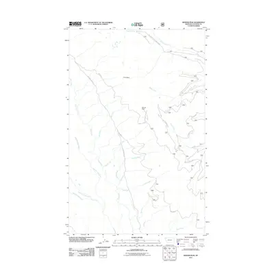
2011 Map of Werner Peak
USGS Topo · Published 2011About this map
Werner Peak and the high ridges of the Whitefish Range define this portion of the Flathead National Forest. In the early 21st century, the landscape is primarily characterized by its drainage systems and the network of forest service roads that provide access to the high country. The prominent China Basin sits at the headwaters of Werner Creek, while the western slopes are carved by the intricate tributaries of Swift Creek, including the East Fork Lazy Creek and Middle Fork Lazy Creek.
Find a feature on this map
25 named features on this map. Tap any name to fly to it.
Don’t see what you’re looking for? This feature index may not catch every label — zoom into the map to look around manually.
Map Details
Editions of this 2011 Werner Peak Map
This is the sole edition of this map. No revisions or reprints were ever made.
Other maps of this area

1906 · Kintla Lakes
USGS Topo · 1:125,000

1913 · Stryker
USGS Topo · 1:125,000

1916 · Stryker
USGS Topo · 1:125,000

1938 · Kintla Lakes
USGS Topo · 1:125,000

1943 · Kalispell
USGS Topo · 1:125,000

1957 · Kalispell
USGS Topo · 1:250,000

1960 · Kalispell
USGS Topo · 1:250,000

1961 · Kalispell
USGS Topo · 1:250,000

1962 · Beaver Lake
USGS Topo · 1:24,000
1962 · Tally Lake
USGS Topo · 1:24,000