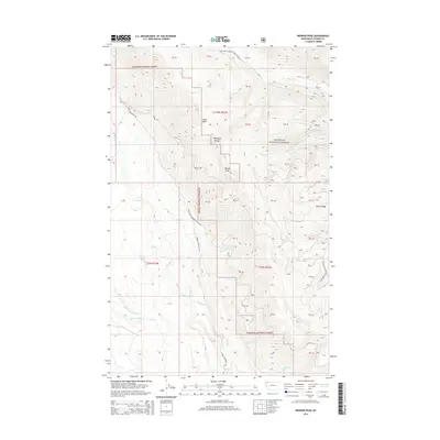
2014 Map of Werner Peak
USGS Topo · Published 2014About this map
Werner Peak stands as the central landmark of this high-elevation terrain within the Flathead National Forest. This 2014 survey documents the drainage systems and access routes that define the Whitefish Range, where numerous creeks including Hallowat Creek, Swift Creek, and Nicola Creek flow through the steep topography. The map illustrates a network of forest management and access roads, such as Lower Whitefish Rd and Whitefish Mountain Radio Rd, which connect the summits to the valleys below. Historically significant features like the Werner Div and the bowl of China Basin provide a detailed look at the geographic character of this corner of Montana. The intersection of major ridges, notably Nicola Ridge, highlights the area's role as a vital watershed feeding the various forks of Lazy Creek, including Middle Fork Lazy Creek and W Fork Lazy Creek.
Find a feature on this map
28 named features on this map. Tap any name to fly to it.
Don’t see what you’re looking for? This feature index may not catch every label — zoom into the map to look around manually.
Map Details
Editions of this 2014 Werner Peak Map
This is the sole edition of this map. No revisions or reprints were ever made.
Other maps of this area

1906 · Kintla Lakes
USGS Topo · 1:125,000

1913 · Stryker
USGS Topo · 1:125,000

1916 · Stryker
USGS Topo · 1:125,000

1938 · Kintla Lakes
USGS Topo · 1:125,000

1943 · Kalispell
USGS Topo · 1:125,000

1957 · Kalispell
USGS Topo · 1:250,000

1960 · Kalispell
USGS Topo · 1:250,000

1961 · Kalispell
USGS Topo · 1:250,000

1962 · Beaver Lake
USGS Topo · 1:24,000
1962 · Tally Lake
USGS Topo · 1:24,000