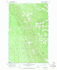
1966 Map of Werner Peak
USGS Topo · Published 1971About this map
Werner Peak serves as the focal point of this high-altitude survey, marking a primary summit within the Whitefish Range. The area is characterized by the convergence of major public lands, split between the Stillwater State Forest to the west and the Flathead National Forest to the east. A prominent Lookout Tower and Prospect atop the peak underscore the region's importance for early fire detection and mineral exploration.
Find a feature on this map
28 named features on this map. Tap any name to fly to it.
Don’t see what you’re looking for? This feature index may not catch every label — zoom into the map to look around manually.
Map Details
Editions of this 1966 Werner Peak Map
This is the sole edition of this map. No revisions or reprints were ever made.
Other maps of this area

1906 · Kintla Lakes
USGS Topo · 1:125,000

1913 · Stryker
USGS Topo · 1:125,000

1916 · Stryker
USGS Topo · 1:125,000

1938 · Kintla Lakes
USGS Topo · 1:125,000

1943 · Kalispell
USGS Topo · 1:125,000

1957 · Kalispell
USGS Topo · 1:250,000

1960 · Kalispell
USGS Topo · 1:250,000

1961 · Kalispell
USGS Topo · 1:250,000

1962 · Beaver Lake
USGS Topo · 1:24,000
1962 · Tally Lake
USGS Topo · 1:24,000