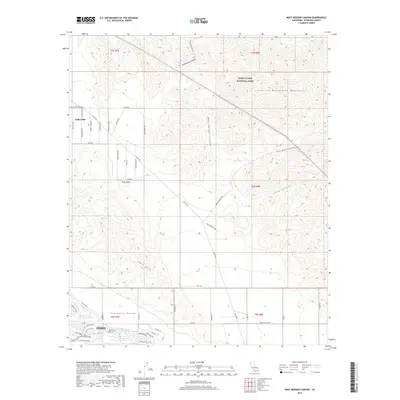
2018 Map of West Berdoo Canyon
USGS Topo · Published 2018About this map
Indio Hills dominate the central landscape of this 2018 survey, marking the transition between the Coachella Valley to the southwest and the Little San Bernardino Mountains to the northeast. The map provides a detailed view of the water infrastructure critical to this desert region, including the Coachella Canal and the Colorado River Aqueduct, which cuts through the foothills of Joshua Tree National Park. The southern portion of the sheet shows the residential expansion of Indio, where established streets like Monroe St and Jackson St meet the undeveloped terrain. Several rugged drainage systems, such as West Berdoo Canyon and Pushwalla Canyon, reveal the complex natural topography that surrounds the modern suburban developments. This survey is particularly useful for visualizing how recent municipal growth interacts with established park boundaries and essential utility corridors.
Find a feature on this map
58 named features on this map. Tap any name to fly to it.
Don’t see what you’re looking for? This feature index may not catch every label — zoom into the map to look around manually.
Map Details
Editions of this 2018 West Berdoo Canyon Map
This is the sole edition of this map. No revisions or reprints were ever made.
Other maps of this area

1904 · Indio
USGS Topo · 1:125,000

1941 · Toro Peak
USGS Topo · 1:62,500

1941 · Coachella
USGS Topo · 1:62,500

1941 · Edom
USGS Topo · 1:62,500

1943 · Coachella
USGS Topo · 1:62,500

1944 · Toro peak
USGS Topo · 1:62,500

1944 · Edom
USGS Topo · 1:62,500

1944 · Pinyon Well
USGS Topo · 1:62,500

1947 · Santa Ana
USGS Topo · 1:250,000

1949 · Santa Ana
USGS Topo · 1:250,000