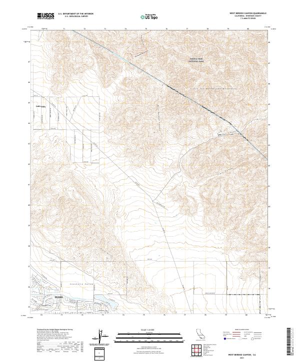
2021 Map of West Berdoo Canyon
USGS Topo · Published 2021About this map
Joshua Tree National Park occupies the northern reaches of this map, where the high desert terrain of the Little San Bernardino Mountains gives way to deep erosional features like Pushwalla Canyon and Berdoo Canyon. The landscape is a study in water management and desert infrastructure, dominated by the path of the Colorado River Aqueduct as it traverses the hills. To the south, the transition into the Coachella Valley is marked by the developed edges of Indio, where the Coachella Canal provides essential irrigation. This modern survey illustrates the sharp contrast between the protected wilderness areas and the expanding residential and agricultural grid of the valley floor, connected by historic desert routes like Old Aqueduct Rd and Dillon Rd.
Find a feature on this map
58 named features on this map. Tap any name to fly to it.
Don’t see what you’re looking for? This feature index may not catch every label — zoom into the map to look around manually.
Map Details
Editions of this 2021 West Berdoo Canyon Map
This is the sole edition of this map. No revisions or reprints were ever made.
Other maps of this area

1904 · Indio
USGS Topo · 1:125,000

1941 · Toro Peak
USGS Topo · 1:62,500

1941 · Coachella
USGS Topo · 1:62,500

1941 · Edom
USGS Topo · 1:62,500

1943 · Coachella
USGS Topo · 1:62,500

1944 · Toro peak
USGS Topo · 1:62,500

1944 · Edom
USGS Topo · 1:62,500

1944 · Pinyon Well
USGS Topo · 1:62,500

1947 · Santa Ana
USGS Topo · 1:250,000

1949 · Santa Ana
USGS Topo · 1:250,000