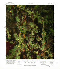
1977 Map of West Berkshire Station
USGS Topo · Published 1978About this map
The Canada United States border divides this 1970s aerial survey, where agricultural patterns and forested tracts define the rural landscape of Franklin County and southern Quebec. Centered on the Pike River corridor, the map highlights the critical infrastructure of international transit, specifically the West Berkshire Station U S Customs and Frelighsburg Canadian Customs points. These stations served as the primary conduits for local commerce and travel between West Berkshire and Frelighsburg.
Find a feature on this map
21 named features on this map. Tap any name to fly to it.
Don’t see what you’re looking for? This feature index may not catch every label — zoom into the map to look around manually.
Map Details
Editions of this 1977 West Berkshire Station Map
This is the sole edition of this map. No revisions or reprints were ever made.
Other maps of this area

1919 · Montgomery
USGS Topo · 1:62,500

1920 · Franklin Pond
USGS Topo · 1:62,500

1920 · Montgomery
USGS Topo · 1:62,500

1922 · Enosburg Falls
USGS Topo · 1:48,000

1924 · Enosburg Falls
USGS Topo · 1:62,500

1925 · Jay Peak
USGS Topo · 1:62,500

1943 · Jay Peak
USGS Topo · 1:62,500

1944 · Enosburg Falls
USGS Topo · 1:62,500

1950 · Lake Champlain
USGS Topo · 1:250,000

1953 · Jay Peak
USGS Topo · 1:62,500