2023 Map of West Chazy
USGS Topo · Published 2023About this map
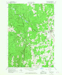
The Little Chazy River flows through this northeastern New York landscape, carving a path toward the settlement of West Chazy. The area is defined by its transition from the elevations of Rand Hill and Pine Ridge in the west down toward the flatter agricultural lands of the Champlain Valley. Long-established transport routes like the Military Tpke anchor the small communities of West Beekmantown and Robinson, while the local genealogy is preserved at sites like Saint Josephs Cem and the West Chazy Rural Cem. Notable landforms such as Cobblestone Hill and Negro Hill stand between the many small waterways, including Corbeau Creek and Farrell Brook, that drain this rural portion of Clinton County. The pattern of development here reflects a mix of traditional crossroads and newer residential clusters like Stoney Acres Dr, all situated within a network of historic thoroughfares.
Find a feature on this map
70 named features on this map. Tap any name to fly to it.
Don’t see what you’re looking for? This feature index may not catch every label — zoom into the map to look around manually.
Map Details
Editions of this 2023 West Chazy Map
This is the sole edition of this map. No revisions or reprints were ever made.