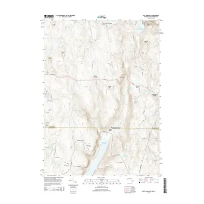
2015 Map of West Granville
USGS Topo · Published 2015About this map
Barkhamsted Reservoir and the Cobble Mountain Reservoir dominate this highland landscape straddling the Massachusetts and Connecticut border. The area is defined by its water management and agricultural history, featuring small settlements such as West Granville and West Hartland that have persisted through the 21st century. The topography is dotted with family-named summits like Sweetman Mtn, Babb Hill, and Winchell Mtn, reflecting generations of land ownership. Genealogists will find several burial grounds preserved here, including the South Quarter Cem and Tolland Cem in the north, and the West Hartland Cem near the southern boundary. The infrastructure of the region is further characterized by the Wild Cat Aqueduct and the presence of Morehaven Airport, showing the intersection of rural life with essential water utility and aviation needs. The winding course of the Hubbard River and Valley Brook provides a clear view of how the natural drainage shaped the road networks and village locations.
Find a feature on this map
86 named features on this map. Tap any name to fly to it.
Don’t see what you’re looking for? This feature index may not catch every label — zoom into the map to look around manually.
Map Details
Editions of this 2015 West Granville Map
This is the sole edition of this map. No revisions or reprints were ever made.
Other maps of this area

1887 · Granville
USGS Topo · 1:62,500

1888 · Sandisfield
USGS Topo · 1:62,500

1889 · Granville
USGS Topo · 1:62,500

1892 · Winsted
USGS Topo · 1:62,500

1892 · Granby
USGS Topo · 1:62,500

1893 · Granville
USGS Topo · 1:62,500

1893 · Sandisfield
USGS Topo · 1:62,500

1895 · Granville
USGS Topo · 1:62,500

1896 · Holyoke
USGS Topo · 1:125,000

1897 · Sandisfield
USGS Topo · 1:62,500