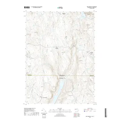
2018 Map of West Granville
USGS Topo · Published 2018About this map
West Granville and West Hartland anchor this survey of the high-elevation borderlands where Massachusetts meets Connecticut. The terrain is defined by a dense network of water features and north-south ridges, including the prominent Cobble Mtn and Winchell Mtn. In the northeast, the Cobble Mountain Reservoir and the Wild Cat Aqueduct reflect the critical regional infrastructure managed for water supply. For genealogists, the map preserves the locations of several burial grounds, including Tolland Cem and the South Quarter Cem. The network of backroads such as Millstone Rd and Whisker Hollow Rd connects old mountain settlements like Baird Four Corners and Twining Hollow, tracing the settlement patterns of the Berkshire foothills and the upper Litchfield Hills.
Find a feature on this map
94 named features on this map. Tap any name to fly to it.
Don’t see what you’re looking for? This feature index may not catch every label — zoom into the map to look around manually.
Map Details
Editions of this 2018 West Granville Map
This is the sole edition of this map. No revisions or reprints were ever made.
Other maps of this area

1887 · Granville
USGS Topo · 1:62,500

1888 · Sandisfield
USGS Topo · 1:62,500

1889 · Granville
USGS Topo · 1:62,500

1892 · Winsted
USGS Topo · 1:62,500

1892 · Granby
USGS Topo · 1:62,500

1893 · Granville
USGS Topo · 1:62,500

1893 · Sandisfield
USGS Topo · 1:62,500

1895 · Granville
USGS Topo · 1:62,500

1896 · Holyoke
USGS Topo · 1:125,000

1897 · Sandisfield
USGS Topo · 1:62,500