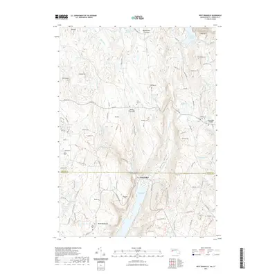
2021 Map of West Granville
USGS Topo · Published 2021About this map
Barkhamsted Reservoir and Cobble Mountain Reservoir dominate this part of the Connecticut and Massachusetts borderlands, reflecting a landscape defined by significant water management infrastructure. The terrain is a network of ridges and hollows, including Wildcat Ridge and Twining Hollow, which contain several critical water bodies like the Borden Brook Reservoir and the Wild Cat Aqueduct. The area preserves a quiet, rural character with small crossroads settlements like West Granville and West Hartland. Genealogists will find several burial grounds across the hills, such as Tolland Cem and the South Quarter Cem. The map illustrates the 2021 state of this highland region, where the Hubbard River and its tributaries carve through the upland topography of Hampden Co and Hartford Co.
Find a feature on this map
117 named features on this map. Tap any name to fly to it.
Don’t see what you’re looking for? This feature index may not catch every label — zoom into the map to look around manually.
Map Details
Editions of this 2021 West Granville Map
This is the sole edition of this map. No revisions or reprints were ever made.
Other maps of this area

1887 · Granville
USGS Topo · 1:62,500

1888 · Sandisfield
USGS Topo · 1:62,500

1889 · Granville
USGS Topo · 1:62,500

1892 · Winsted
USGS Topo · 1:62,500

1892 · Granby
USGS Topo · 1:62,500

1893 · Granville
USGS Topo · 1:62,500

1893 · Sandisfield
USGS Topo · 1:62,500

1895 · Granville
USGS Topo · 1:62,500

1896 · Holyoke
USGS Topo · 1:125,000

1897 · Sandisfield
USGS Topo · 1:62,500