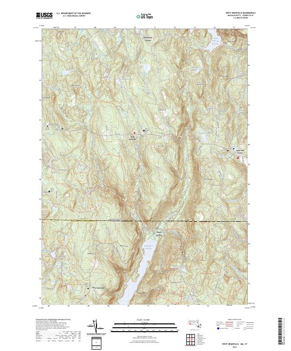
2024 Map of West Granville
USGS Topo · Published 2024About this map
The Hubbard River cuts a deep valley through this borderland between Massachusetts and Connecticut, shaping the settlement patterns of West Granville and Granville Center. The topography is defined by high points like Ore Hill and Winchell Mtn, with the landscape transitioning into the protected waters of the Barkhamsted Reservoir to the south. For local historians, the area is notable for its concentration of early burying grounds, including Spring Hill Cem, Hamilton Cem, and West Granville Cem. The southern portion of the map enters the Tunxis Forest and features the settlement of West Hartland. This 2024 edition documents the modern road network, from Main Rd to more isolated routes like Farnum Rd, while preserving the locations of numerous family-named landmarks and brooks such as Phelon Brook and Tillotson Brook.
Find a feature on this map
116 named features on this map. Tap any name to fly to it.
Don’t see what you’re looking for? This feature index may not catch every label — zoom into the map to look around manually.
Map Details
Editions of this 2024 West Granville Map
This is the sole edition of this map. No revisions or reprints were ever made.
Other maps of this area

1887 · Granville
USGS Topo · 1:62,500

1888 · Sandisfield
USGS Topo · 1:62,500

1889 · Granville
USGS Topo · 1:62,500

1892 · Winsted
USGS Topo · 1:62,500

1892 · Granby
USGS Topo · 1:62,500

1893 · Granville
USGS Topo · 1:62,500

1893 · Sandisfield
USGS Topo · 1:62,500

1895 · Granville
USGS Topo · 1:62,500

1896 · Holyoke
USGS Topo · 1:125,000

1897 · Sandisfield
USGS Topo · 1:62,500