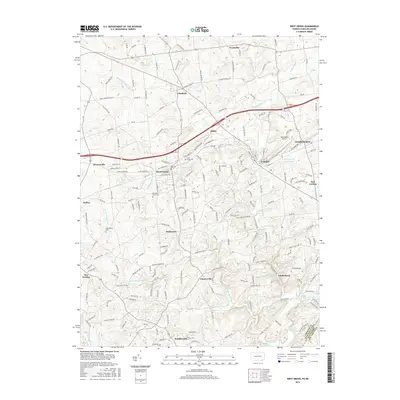
2016 Map of West Grove
USGS Topo · Published 2016About this map
The Middle Br White Clay Cr and its numerous tributaries, such as Trout Run and Lenni-Lenape Run, carve through this section of Chester County, defining the settlement patterns of West Grove and Avondale. This landscape is characterized by its complex network of local roads and longstanding village centers, where agriculture and suburban growth meet near the Delaware state line. In the southern portion of the map, White Clay Cr flows toward the tri-state area, passing the community of Landenberg. Genealogical interest is concentrated in several burial sites, including Saint Marys Cem near Baker and the Episcopalian Cem located between Jennersville and Wickerton. The presence of features like Mushroom Run reflects the specialized agricultural heritage of this region, while names like Green Valley Farms Lake indicate more modern residential developments that have integrated into the older rural framework.
Find a feature on this map
189 named features on this map. Tap any name to fly to it.
Don’t see what you’re looking for? This feature index may not catch every label — zoom into the map to look around manually.
Map Details
Editions of this 2016 West Grove Map
This is the sole edition of this map. No revisions or reprints were ever made.
Other maps of this area

1898 · Elkton
USGS Topo · 1:62,500

1900 · Elkton
USGS Topo · 1:62,500

1901 · West Chester
USGS Topo · 1:62,500

1904 · West Chester
USGS Topo · 1:62,500

1904 · Coatesville
USGS Topo · 1:62,500

1904 · Wilmington
USGS Topo · 1:62,500

1906 · Coatesville
USGS Topo · 1:62,500

1906 · Wilmington
USGS Topo · 1:62,500

1917 · Elkton
USGS Topo · 1:62,500

1918 · Coatesville
USGS Topo · 1:62,500
Featured Places
- New Garden Township, PA
- New London Township, PA
- Franklin Township, PA
- Toughkenamon, New Garden Township
- North Star, Delaware, DE