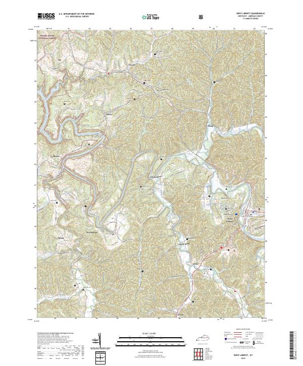
2022 Map of West Liberty
USGS Topo · Published 2022About this map
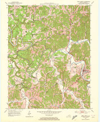
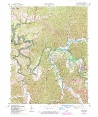
The Licking River winds through the heart of this Morgan County landscape, carving a path between the steep elevations of McClannahan Hill and Wells Hill. As the county seat, West Liberty serves as the primary civic hub, anchored by the Morgan County Judicial Center and surrounded by a network of family-named roads and homesteads. The terrain is characterized by a dense system of tributary hollows, including Grassy Creek, Elk Fork, and Caney Cr, which define the scattered residential patterns of communities like Woodsbend, Index, and Pomp.
Find a feature on this map
107 named features on this map. Tap any name to fly to it.
Don’t see what you’re looking for? This feature index may not catch every label — zoom into the map to look around manually.
Map Details
Editions of this 2022 West Liberty Map
This is the sole edition of this map. No revisions or reprints were ever made.
Historical Maps of Zag Through Time
3 maps found