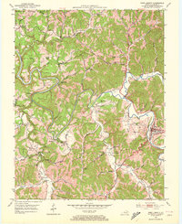
1951 Map of West Liberty
USGS Topo · Published 1972About this map
The Licking River winds deeply through the heart of Morgan County, creating a landscape defined by sharp oxbows and narrow valleys at the mid-century. This 1951 field survey highlights the rural character of West Liberty and its surrounding ridge-and-hollow settlements, including Woodsbend and Zag. The terrain is marked by family-named landmarks and essential community anchors, from the Southfork Ch to the Wells Hill Sch. A portion of the Cumberland National Forest touches the northwest corner, while the presence of a Pipe Line running through the southern hills reflects the modernization of infrastructure through the central Kentucky highlands. Genealogists will find a dense network of family burial grounds such as Cottle Cem, Bishop Cem, and Fugatt Cem scattered across the upland reaches of Elk Fork and Caney Creek.
Find a feature on this map
75 named features on this map. Tap any name to fly to it.
Don’t see what you’re looking for? This feature index may not catch every label — zoom into the map to look around manually.
Map Details
Editions of this 1951 West Liberty Map
2 editions found
Other maps of this area

1889 · Salyersville
USGS Topo · 1:125,000

1891 · Salyersville
USGS Topo · 1:125,000

1899 · Salyersville
USGS Topo · 1:125,000

1929 · Morehead
USGS Topo · 1:48,000

1935 · Morehead
USGS Topo · 1:62,500

1950 · Sandy Hook
USGS Topo · 1:24,000

1950 · Lenox
USGS Topo · 1:24,000

1951 · Cannel City
USGS Topo · 1:24,000

1951 · White Oak
USGS Topo · 1:24,000

1951 · Ezel
USGS Topo · 1:24,000