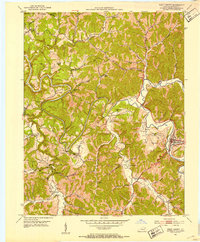
1951 Map of West Liberty
USGS Topo · Published 1953About this map
The Licking River snakes through the heart of Morgan County, carving a deep path through the eastern Kentucky hills. Along its banks, the community of West Liberty serves as a central hub, surrounded by smaller settlements like Woodsbend and Index. This mid-century survey reveals a landscape defined by its rural infrastructure, where numerous small schools and churches anchor local life. The mapping of Woodsbend Sch, Mussel Shoals Sch, and Wells Hill Sch provides a clear view of the educational landscape before widespread consolidation. Family history is etched into the terrain through a high density of family cemeteries, including Cottle Cem, McKinney Cem, and Perry Cem. The northern portion of the map is marked by the Cumberland National Forest Boundary, where the topography becomes increasingly complex around features like Daisy Knob and the winding Elk Fork river.
Find a feature on this map
68 named features on this map. Tap any name to fly to it.
Don’t see what you’re looking for? This feature index may not catch every label — zoom into the map to look around manually.
Map Details
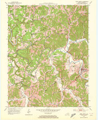
Editions of this 1951 West Liberty Map
2 editions found
Other maps of this area

1889 · Salyersville
USGS Topo · 1:125,000

1891 · Salyersville
USGS Topo · 1:125,000

1899 · Salyersville
USGS Topo · 1:125,000

1929 · Morehead
USGS Topo · 1:48,000

1935 · Morehead
USGS Topo · 1:62,500

1950 · Sandy Hook
USGS Topo · 1:24,000

1950 · Lenox
USGS Topo · 1:24,000

1951 · Cannel City
USGS Topo · 1:24,000

1951 · White Oak
USGS Topo · 1:24,000

1951 · Ezel
USGS Topo · 1:24,000