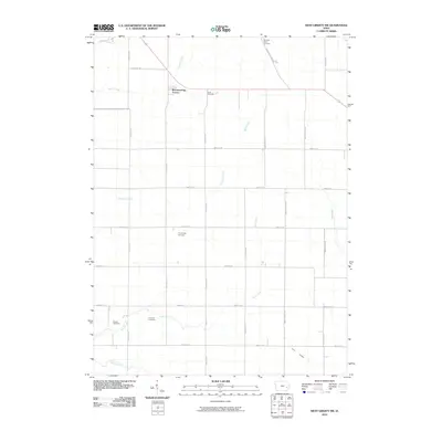
2010 Map of West Liberty SW
USGS Topo · Published 2010About this map
Breckenridge Estates stands as a focal point of residential development within this Johnson County landscape, where the traditional Midwestern grid of section roads meets the natural wanderings of regional waterways. The drainage pattern is defined by the winding paths of Snyder Creek and Pechman Creek, which traverse a terrain largely dedicated to agriculture. This 2010 survey reveals a high concentration of family and community burial sites, indicating a long-settled rural history. Researchers can identify Molback Farm Cemetery in the north, while the southern reaches contain Walker Cemetery and Fountain Cemetery near the banks of Buck Creek. The presence of several named cemeteries like Scott Cemetery and Trowbridge Cemetery alongside engineered features such as Ditch Number 2 illustrates the continued evolution of land management and genealogy in this part of Iowa.
Find a feature on this map
29 named features on this map. Tap any name to fly to it.
Don’t see what you’re looking for? This feature index may not catch every label — zoom into the map to look around manually.
Map Details
Editions of this 2010 West Liberty SW Map
This is the sole edition of this map. No revisions or reprints were ever made.
Other maps of this area

1891 · Iowa City
USGS Topo · 1:62,500

1894 · West Liberty
USGS Topo · 1:62,500

1901 · Stanwood
USGS Topo · 1:125,000

1903 · Fairfax
USGS Topo · 1:125,000

1938 · Iowa City
USGS Topo · 1:62,500

1958 · Davenport
USGS Topo · 1:250,000

1961 · Davenport
USGS Topo · 1:250,000

1962 · Davenport
USGS Topo · 1:250,000
1965 · West Liberty
USGS Topo · 1:24,000
1965 · Iowa City West
USGS Topo · 1:24,000