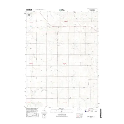
2015 Map of West Liberty SW
USGS Topo · Published 2015About this map
Iowa City extends its reach into the northwest corner of this landscape, where the urban grid gives way to the structured agricultural geometry of Johnson County. The area is defined by a dense network of sectional roads like Sioux Ave SE and 480th St SE, which partition the land between several winding watercourses. Significant for family historians, the sheet records numerous small burial sites preserved amidst the fields, including Molback Farm Cem, Scott Cem, and Trowbridge Cem. The natural drainage of the region is managed through features like Big Slough and the engineered Ditch Number 2, reflecting a long history of land reclamation for farming. This 2015 survey captures the rural character that persists just outside the city limits, from the banks of Snyder Cr to the southern reaches near Otter Cr.
Find a feature on this map
40 named features on this map. Tap any name to fly to it.
Don’t see what you’re looking for? This feature index may not catch every label — zoom into the map to look around manually.
Map Details
Editions of this 2015 West Liberty SW Map
This is the sole edition of this map. No revisions or reprints were ever made.
Other maps of this area

1891 · Iowa City
USGS Topo · 1:62,500

1894 · West Liberty
USGS Topo · 1:62,500

1901 · Stanwood
USGS Topo · 1:125,000

1903 · Fairfax
USGS Topo · 1:125,000

1938 · Iowa City
USGS Topo · 1:62,500

1958 · Davenport
USGS Topo · 1:250,000

1961 · Davenport
USGS Topo · 1:250,000

1962 · Davenport
USGS Topo · 1:250,000
1965 · West Liberty
USGS Topo · 1:24,000
1965 · Iowa City West
USGS Topo · 1:24,000