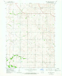
1965 Map of West Liberty SW
USGS Topo · Published 1967About this map
Pleasant Valley and Lincoln townships define this agricultural landscape in Johnson County, where a network of prairie streams feeds the surrounding valley floor. The Chicago Rock Island and Pacific railroad cuts a diagonal line across the northern sections, passing a Pumping Station as it skirts the headwaters of Snyder Creek. For genealogists and local historians, the map preserves the specific locations of several rural burying grounds, including Scott Cem, Walker Cem, and Fountain Cem. The terrain is characterized by the convergence of multiple waterways such as Pechman Creek and Buck Creek, while the southern reaches of Fremont township are marked by the managed drainage of Ditch No 2. This mid-century survey captures a period of established family farms before more modern suburban expansion altered the rural character of the corridor between Iowa City and West Liberty.
Find a feature on this map
17 named features on this map. Tap any name to fly to it.
Don’t see what you’re looking for? This feature index may not catch every label — zoom into the map to look around manually.
Map Details
Editions of this 1965 West Liberty SW Map
This is the sole edition of this map. No revisions or reprints were ever made.
Other maps of this area

1891 · Iowa City
USGS Topo · 1:62,500

1894 · West Liberty
USGS Topo · 1:62,500

1901 · Stanwood
USGS Topo · 1:125,000

1903 · Fairfax
USGS Topo · 1:125,000

1938 · Iowa City
USGS Topo · 1:62,500

1958 · Davenport
USGS Topo · 1:250,000

1961 · Davenport
USGS Topo · 1:250,000

1962 · Davenport
USGS Topo · 1:250,000
1965 · West Liberty
USGS Topo · 1:24,000
1965 · Iowa City West
USGS Topo · 1:24,000