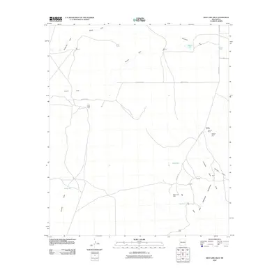
2010 Map of West Lime Hills
USGS Topo · Published 2010About this map
The Mahoney Mining Area and its associated Mahoney Mines define the industrial footprint of this arid reach in Luna County. Located south of County Rd-C013, the landscape transitions from the broad alluvial fans of the north to the sharp relief of the Tres Hermanas Mountains in the south. This transition is marked by a network of ephemeral water features including Bisbee Draw and Tomerlin Draw, alongside man-made water catchments like Jog Tank and Bassett Lake that support local ranching operations like the White House Ranch.
Find a feature on this map
29 named features on this map. Tap any name to fly to it.
Don’t see what you’re looking for? This feature index may not catch every label — zoom into the map to look around manually.
Map Details
Editions of this 2010 West Lime Hills Map
This is the sole edition of this map. No revisions or reprints were ever made.
Other maps of this area

1899 · Deming
USGS Topo · 1:125,000

1915 · Deming
USGS Topo · 1:125,000

1917 · Hermanas
USGS Topo · 1:62,500

1917 · Columbus
USGS Topo · 1:62,500

1918 · Columbus
USGS Topo · 1:62,500

1918 · Hermanas
USGS Topo · 1:62,500

1920 · Columbus
USGS Topo · 1:62,500

1943 · Hermanas
USGS Topo · 1:62,500

1953 · El Paso
USGS Topo · 1:250,000

1955 · Las Cruces
USGS Topo · 1:250,000