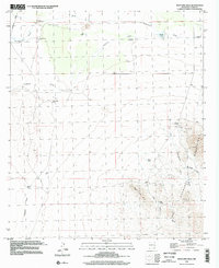
1996 Map of West Lime Hills
USGS Topo · Published 2002About this map
White House Ranch sits at the center of this high-desert landscape in Luna County, serving as a primary point of human settlement amidst a network of drainage draws and ranching infrastructure. The terrain is defined by the sharp rise of the Hermanas Mountains in the east and the West Lime Hills to the south. Water management is the visible priority of the era, marked by numerous named catchments and pumping points such as Jog Windmill, Swope Windmill, and Bassett Lake. Extraction history is anchored in the southeast corner near the mountains, where the Mahoney Mines and several other prospect points are located. These features, along with the numerous 4WD tracks and dry washes like Tomerlin Draw and Lonesome Cabin Draw, illustrate the isolation and specialized land use of this New Mexico borderland region in the late twentieth century.
Find a feature on this map
25 named features on this map. Tap any name to fly to it.
Don’t see what you’re looking for? This feature index may not catch every label — zoom into the map to look around manually.
Map Details
Editions of this 1996 West Lime Hills Map
This is the sole edition of this map. No revisions or reprints were ever made.
Other maps of this area

1899 · Deming
USGS Topo · 1:125,000

1915 · Deming
USGS Topo · 1:125,000

1917 · Hermanas
USGS Topo · 1:62,500

1917 · Columbus
USGS Topo · 1:62,500

1918 · Columbus
USGS Topo · 1:62,500

1918 · Hermanas
USGS Topo · 1:62,500

1920 · Columbus
USGS Topo · 1:62,500

1943 · Hermanas
USGS Topo · 1:62,500

1953 · El Paso
USGS Topo · 1:250,000

1955 · Las Cruces
USGS Topo · 1:250,000