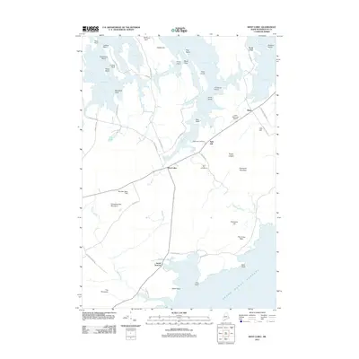
2011 Map of West Lubec
USGS Topo · Published 2011About this map
West Lubec and the surrounding coastal landscape of Washington County are defined by a complex network of bays, inlets, and islands facing the Grand Manan Channel. The interior is punctuated by distinct high points like Porcupine Mountain and Christmas Tree Mountain, while the jagged coastline is shaped by features such as Coffins Point and Horan Head. The 2011 infrastructure includes the Lubec Municipal Airport and a series of rural roads, including Lead Mine Rd and Boot Cove Rd, which connect scattered coastal settlements. For genealogists and local historians, the West Lubec Cemetery and the positions of North Lubec and South Trescott offer clear reference points for tracing property and family locations in this maritime environment. The shoreline is especially intricate around Straight Bay and South Bay, where numerous islands like Parker Island and Long Island dominate the tidal landscape.
Find a feature on this map
63 named features on this map. Tap any name to fly to it.
Don’t see what you’re looking for? This feature index may not catch every label — zoom into the map to look around manually.
Map Details
Editions of this 2011 West Lubec Map
This is the sole edition of this map. No revisions or reprints were ever made.
Other maps of this area

1907 · Eastport
USGS Topo · 1:48,000

1908 · Eastport
USGS Topo · 1:62,500

1917 · Cutler
USGS Topo · 1:62,500

1918 · Cutler
USGS Topo · 1:62,500

1943 · Eastport
USGS Topo · 1:62,500

1945 · Eastport
USGS Topo · 1:62,500

1949 · Whiting
USGS Topo · 1:24,000

1949 · Pembroke
USGS Topo · 1:24,000

1949 · Eastport
USGS Topo · 1:24,000

1949 · West Lubec
USGS Topo · 1:24,000