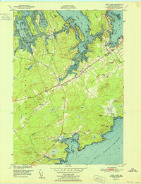
1951 Map of West Lubec
USGS Topo · Published 1951About this map
Coastal Washington County is defined here by the intricate shoreline of Johnson Bay and the Grand Manan Channel, where tidal inlets and necks create a complex maritime landscape. Settlements like North Lubec and West Lubec serve as small hubs for the surrounding farm and forest lands, connected by the emerging infrastructure of the mid-20th century, including the Lubec Airport and U.S. 1. The map illustrates the community foundations of the era, from the Baptist Ch and West Lubec Cem to the local Wilcox Sch and Crow Neck Sch.
Find a feature on this map
61 named features on this map. Tap any name to fly to it.
Don’t see what you’re looking for? This feature index may not catch every label — zoom into the map to look around manually.
Map Details
Editions of this 1951 West Lubec Map
This is the sole edition of this map. No revisions or reprints were ever made.
Other maps of this area

1907 · Eastport
USGS Topo · 1:48,000

1908 · Eastport
USGS Topo · 1:62,500

1917 · Cutler
USGS Topo · 1:62,500

1918 · Cutler
USGS Topo · 1:62,500

1943 · Eastport
USGS Topo · 1:62,500

1945 · Eastport
USGS Topo · 1:62,500

1949 · Whiting
USGS Topo · 1:24,000

1949 · Pembroke
USGS Topo · 1:24,000

1949 · Eastport
USGS Topo · 1:24,000

1949 · West Lubec
USGS Topo · 1:24,000